
Govie - 3DIT's Viewer Technology
Govie® - The core of all applications
Govie is a 3D viewer technology for 3D, CAD, BIM, and geospatial data in the browser, consolidating 3DIT's expertise.
It includes a WebViewer for rendering, an asset pipeline for processing, and an integration setup for existing web applications.
The viewer runs natively in the browser without any installation or plugin, and can be embedded into any frontend ecosystem. Compatible with desktop, mobile, VR, and AR.


































These companies rely on the Govie 3D-Viewer Technology for their B2B communications
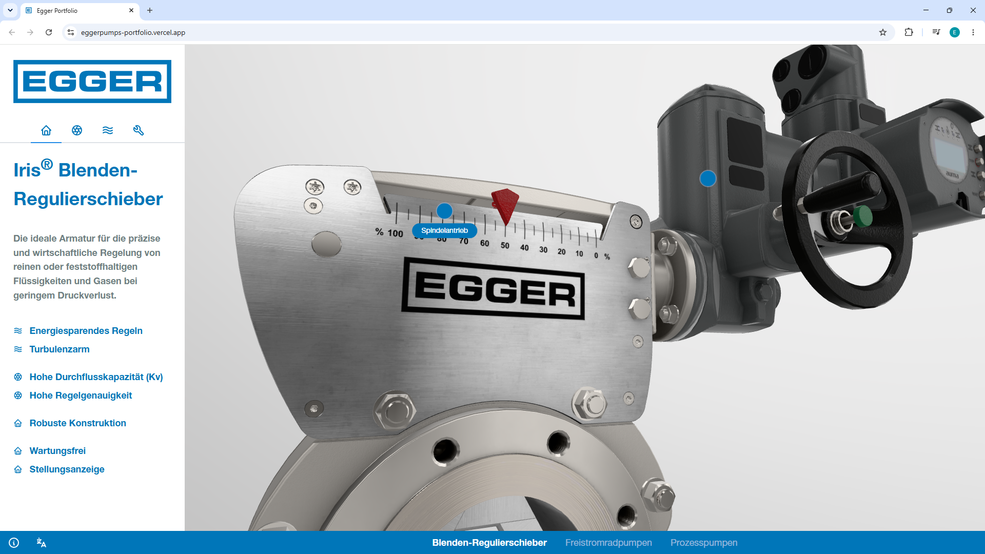
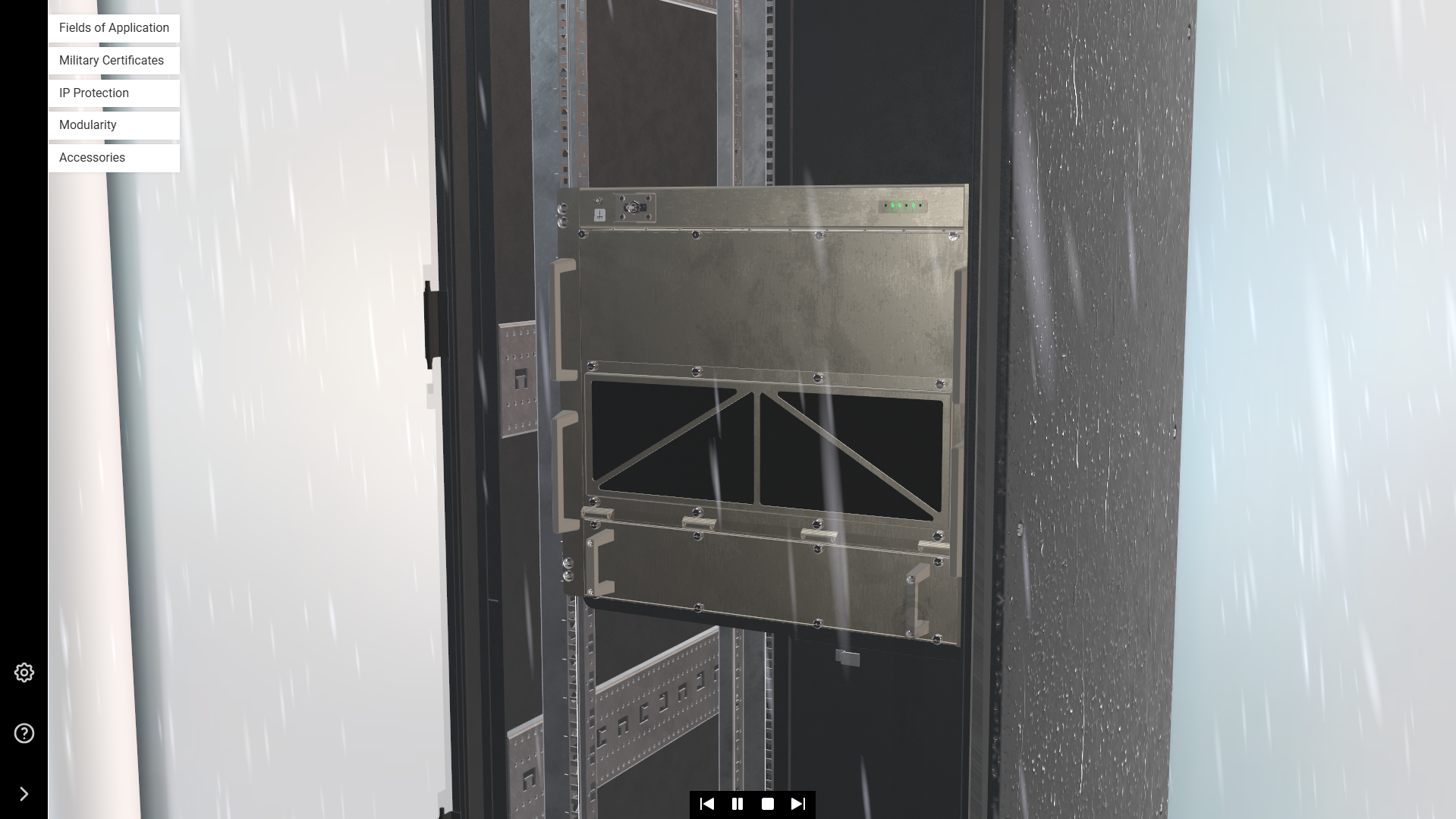
Display machinery, complex animations, and particle flows photorealistically on the web!
Visual Quality
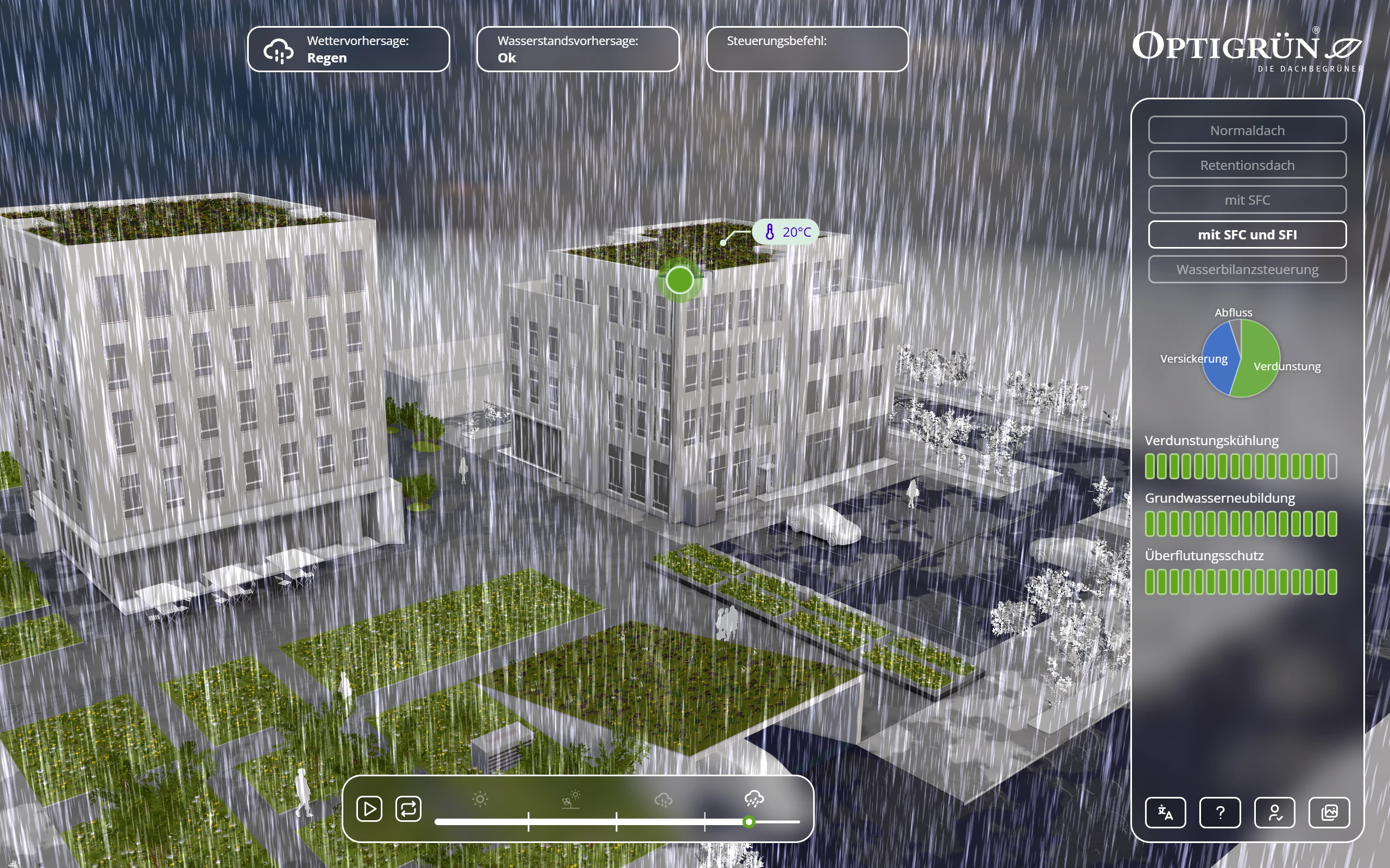
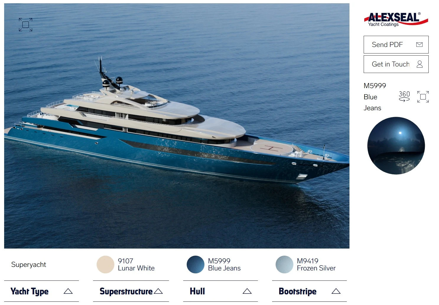
Govie is a 3D viewer technology for complex visualizations of 3D, CAD, BIM, and geospatial data. It runs natively in the browser without installation and can be embedded in any frontend ecosystem – desktop, mobile, VR, and AR. The engine combines photorealistic rendering techniques with technical visualizations: PBR material systems for physically correct surface representation, advanced lighting algorithms, and Non-Photorealistic Rendering (NPR) for hidden-line rendering, cross-sections, and construction drawings.
Technical Competencies
- Physically Based Rendering (PBR) & Material System: Microfacet-based shading with albedo, roughness, metalness, normal maps, and parallax occlusion mapping. Material features: Clearcoat (multi-layer coatings), Sheen (silky-looking textiles), Iridescence (color shifting). Real-time switching between PBR materials and functional modes (X-ray, heatmaps, cross-sections) without scene reloading.
- Image Based Lighting (IBL) & Environment Mapping: HDRI textures with precomputed Radiance Maps and Irradiance Probes for global illumination. Specular reflections and indirect shadows without real-time light sources.
- Shadowing & Depth Effects: Shadow mapping with Percentage Closer Filtering (PCF) and Cascade Shadow Maps. Local shadowing via SSAO. Optional SSR and SSGI for specular and diffuse spatial effects.
Display complex information interactively across different scenarios!
Interactivity
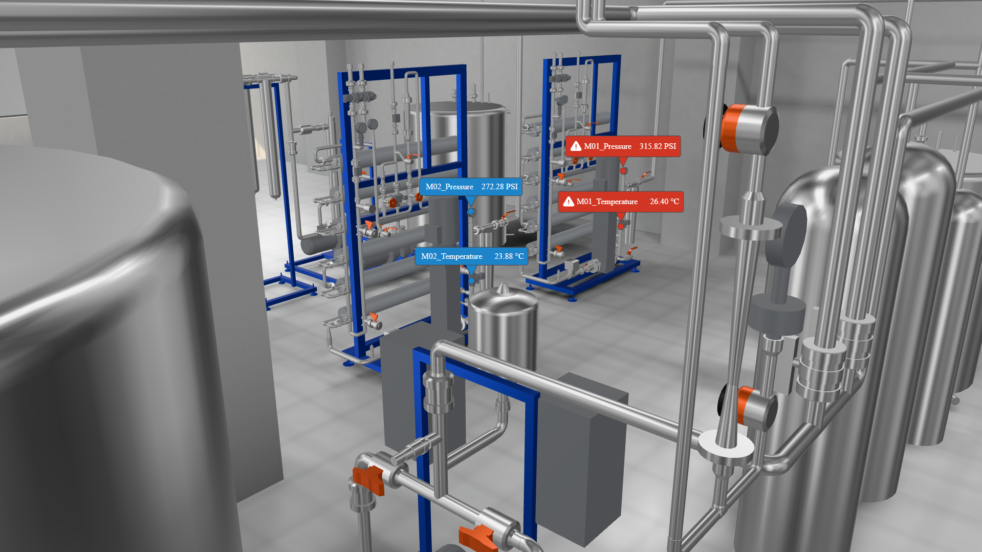
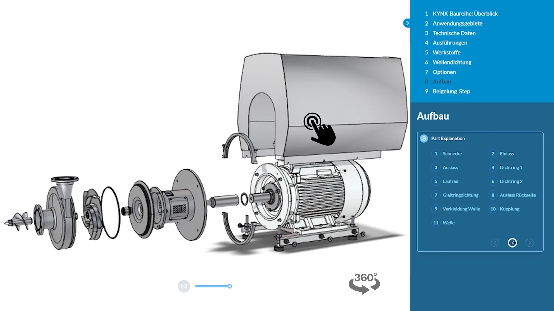
The viewer treats the 3D scene as an interactive information layer. Selected objects can be transformed directly in space. Predefined scenarios switch layers, animations, and states via a state manager without reloading the scene. Additionally, any external data layers can be spatially embedded: annotations, hotspots, sensor values, or heatmaps are overlaid as 2D screen elements on top of geometry and remain correctly positioned during camera movement. For immersive use cases, a complete WebXR integration is available.
Technical Competencies
- Object Manipulation & Transform Controls: Objects can be moved, rotated, and scaled directly in the scene via gizmos and axis-bound handles. Transformations occur in local or global coordinate spaces, with support for snap-to-grid and free input constraints.
- GPU-side Picking & Raycasting: Object selection via GPU-based picking (framebuffer readback) or CPU-side ray-triangle intersection. Hit accuracy at mesh level, even with complex overlaps and thousands of objects. Multi-select via box selection possible.
- Screen-Space UI & Labeling: Annotations, labels, and hotspots are spatially bound to objects and remain correctly positioned during camera movement (Css2D renderer). Occluded labels are automatically hidden or sorted by priority. Supports text, images, and HTML-based UI elements.
- State Management & Scenario Control: Predefined scenarios control visibility, animations, and material states without reloading the scene. Event-based triggers enable contextual reactions to user interactions (selection, hover, click). WebXR integration for immersive controls (hand tracking, controller input) in VR and AR applications.
Fluid rendering of large volumes of 3D data directly in the browser!
Performance
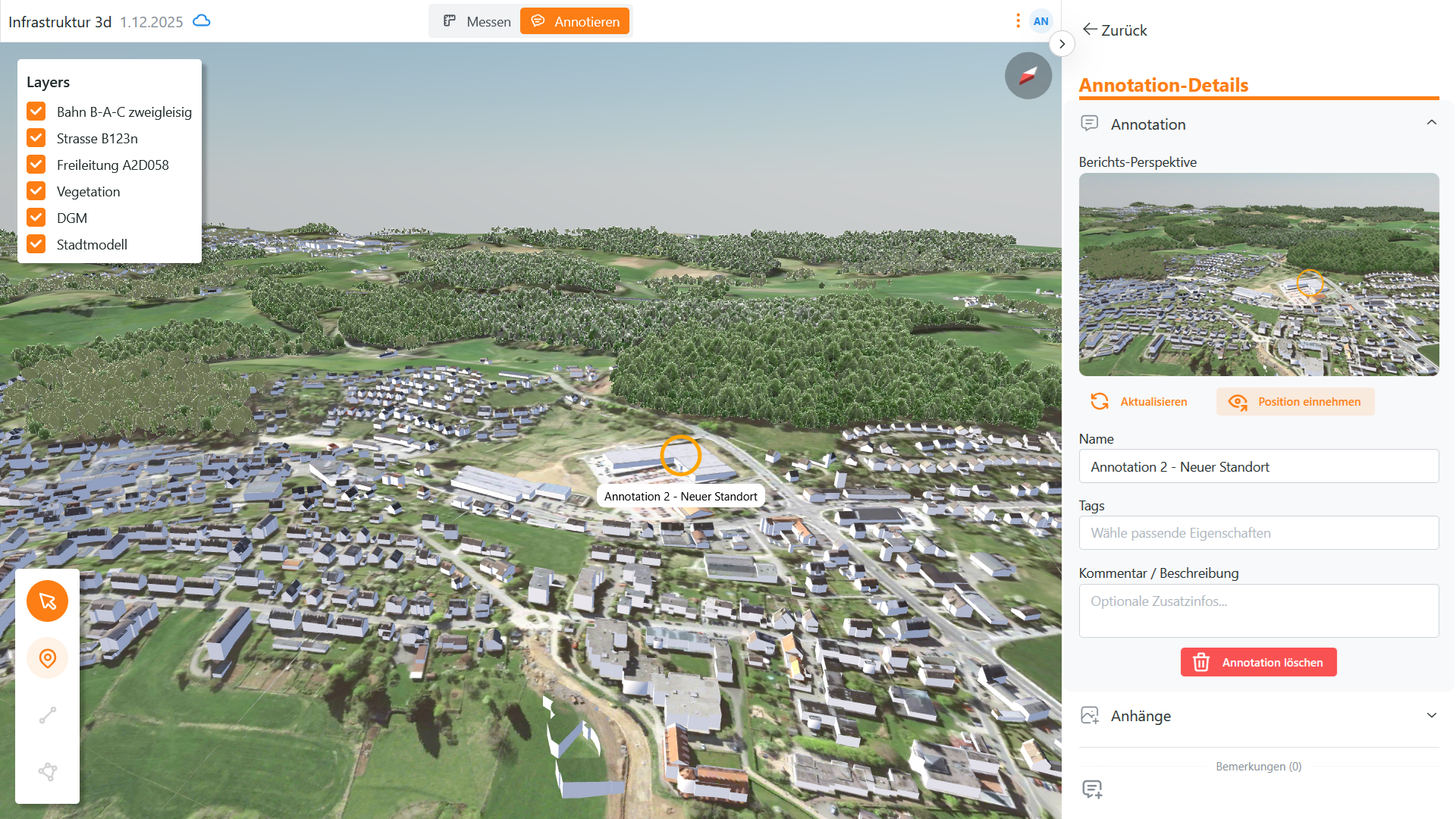
Large scenes with heterogeneous data sources are rendered efficiently on end devices through two complementary strategies: An offline pipeline optimizes geometries before delivery through reduction and level-of-detail generation. Govie's runtime engine intelligently selects visible detail levels, discards geometry outside the viewport, and loads missing data on demand. This keeps memory consumption constant, even with complex data sources (CAD, BIM, LIDAR, GIS) on mobile and desktop devices without user-side optimizations.
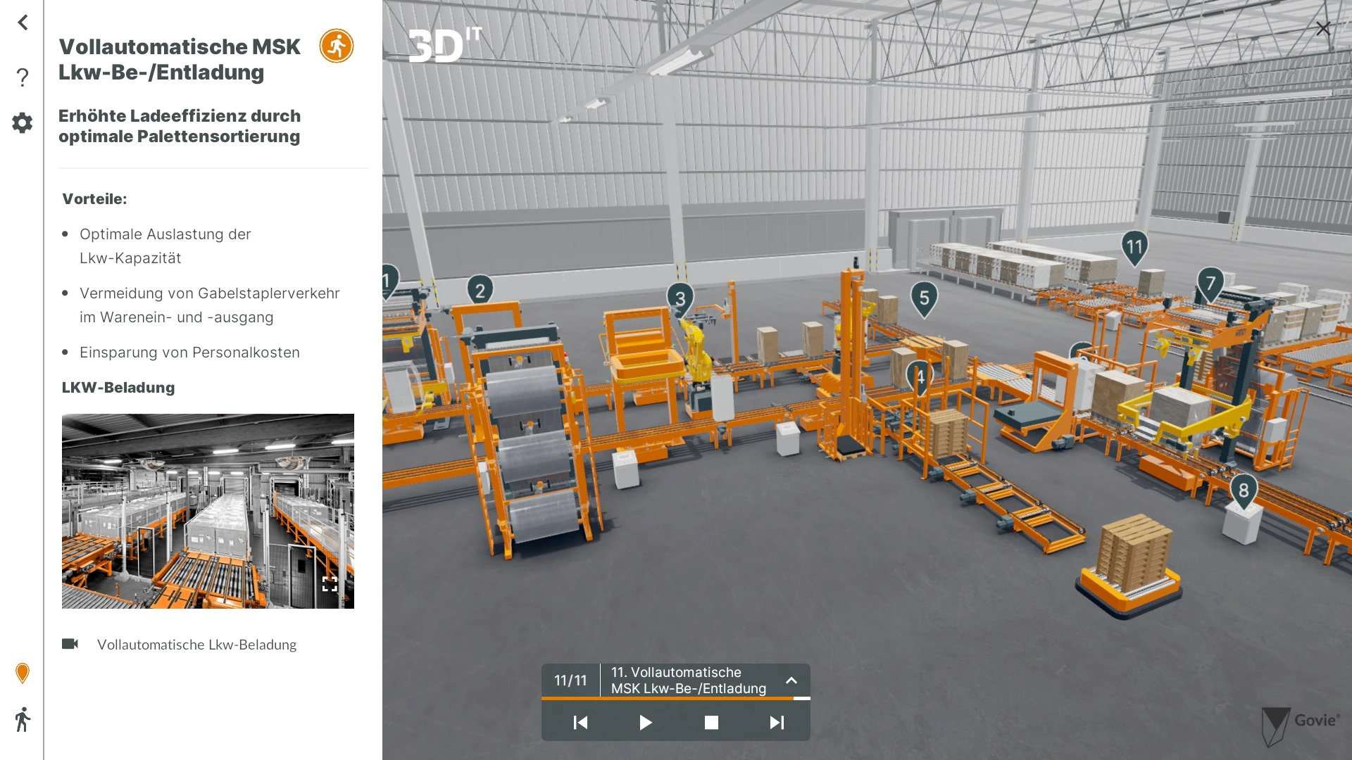
Technical Competencies
Offline Pipeline
- CAD Reduction & Defeaturing: A pipeline specifically designed for CAD data optimizes the scope of BREP models. Defeaturing removes irrelevant construction details, proxy geometries replace complex structures, shrinkwraps (outer shell approximation) drastically reduce polygon count without losing visual details.
- LOD Generation & Texture Baking: Multiple discrete detail levels are automatically generated from the source mesh. Surface details (unevenness, scratches, textures) are transferred via texture baking into normal and roughness maps, so low-poly meshes appear visually detailed.
- Spatial Hierarchization & Clustering: Regardless of source format, all objects are organized into a unified spatial hierarchy (octree, quadtree, 3D Tiles per Cesium standard). This hierarchy enables efficient culling and streaming at runtime – only visible or nearby tiles are loaded.
Online Rendering Techniques (Runtime)
- LOD Selection & Distance Culling: The renderer automatically selects the appropriate detail level per object based on camera distance and available GPU memory. Objects beyond viewing distance are completely skipped (frustum culling). Continuous LOD transitions prevent pop-in artifacts.
- Visibility Culling & Occlusion: Objects outside the view area or behind other geometries are skipped. Non-visible content generates no GPU load. Hierarchy-based culling enables processing of large scenes (>1 million objects).
- GPU Instancing & Batch Rendering: Similar objects (screws, supports, repeating elements) are rendered as single GPU draw calls (instancing), regardless of count. Multiple meshes are combined into large batches to minimize render overhead.
- Streaming & Adaptive Compression: Scene tiles are reloaded on demand. Visible tiles are transmitted with priority, missing data asynchronously in background. Mesh-based compression (Draco, Meshopt) reduces file size by 90% without losing geometry quality.
Seamlessly and flexibly integrate the 3D viewer into existing web apps
Integration
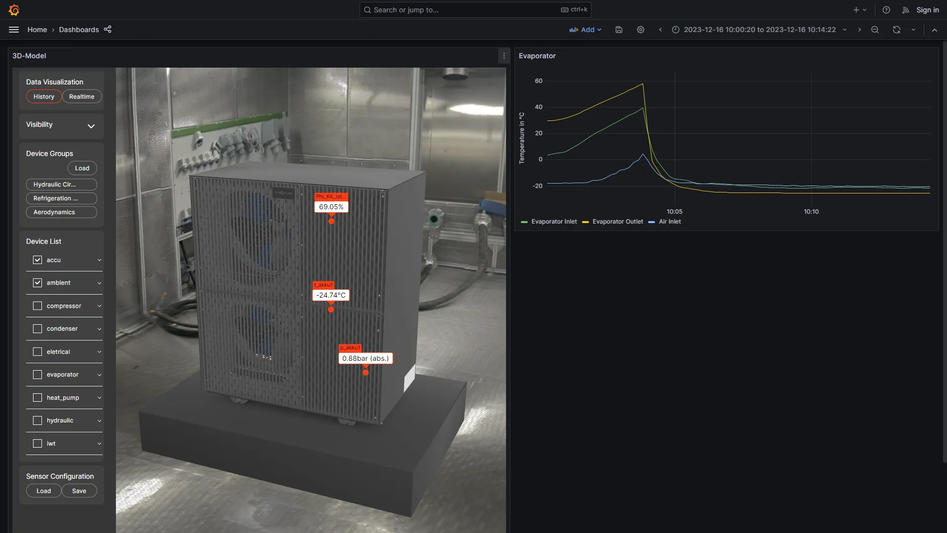
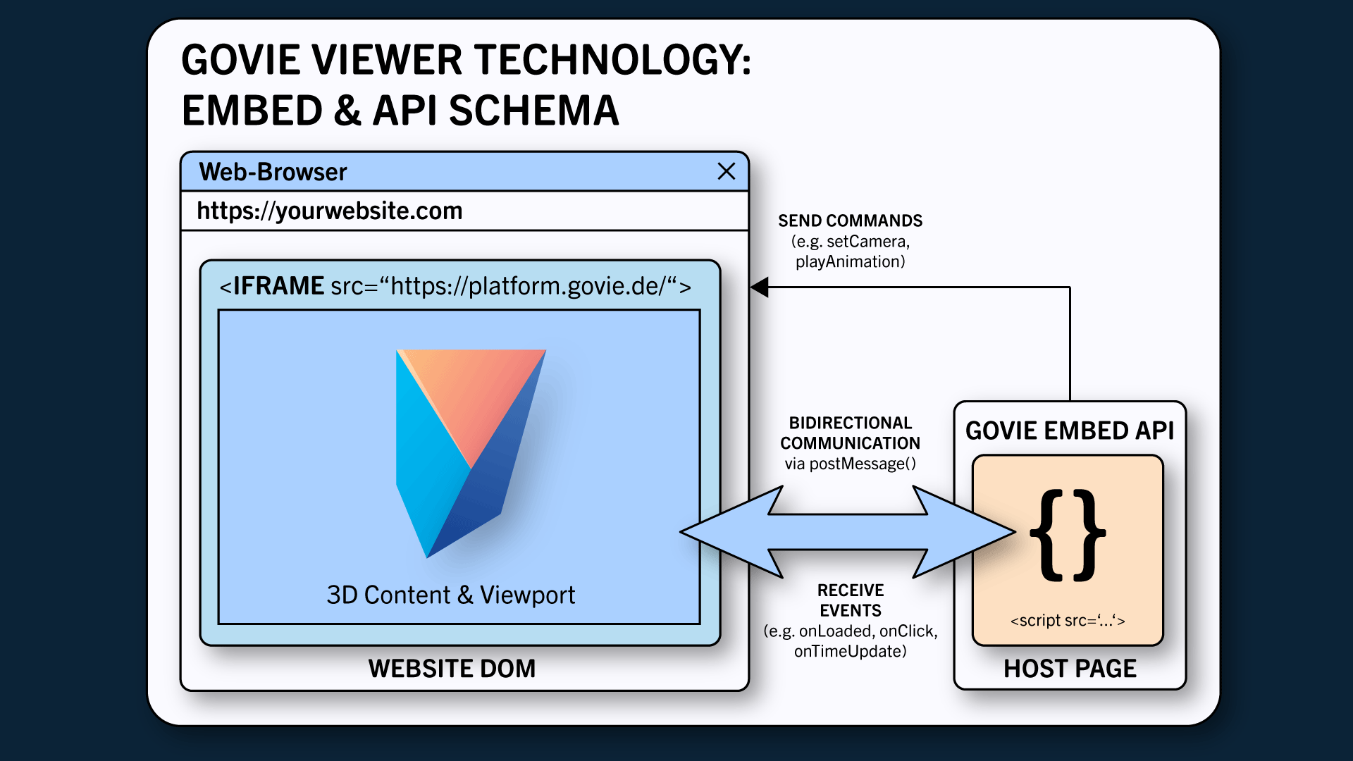
The Govie 3D engine is integrated as an encapsulated module via an API bridge into existing web applications. The viewer runs isolated in the browser and communicates bidirectionally with the host frontend (e.g., React, Vue, Angular) – for camera control, object selection, and dynamic data updates without scene reloading. Automated asset pipelines prepare CAD data before delivery, while standardized WebSocket channels synchronize real-time data streams (IoT sensors, metadata) spatially with the 3D scene.
Technical Competencies
- Web Embedding & Frontend Integration: The viewer runs as an encapsulated module (Web Component) in the browser and communicates via bidirectional API bridge with the host frontend (React, Vue, Angular). Frame-synchronous communication enables synchronization of camera position, object selections, and attribute data between viewer and application.
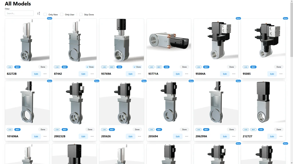
- Integration of various CAD formats: Govie supports proprietary and standardized data formats (STEP, IGES, Parasolid, Catia, Solidworks, Inventor, FreeCAD). All formats are converted into a unified runtime format and automatically optimized for web display (geometry reduction, material normalization, texture adaptation).
- Real-time sync & live data binding: Standardized WebSocket channels synchronize real-time data streams (IoT sensors, measurement data, states) spatially with the 3D scene. Data synchronization (e.g., of position and viewing direction, user comments, etc.) also enables multi-user collaboration.
Protection of CAD data and intellectual property
Security
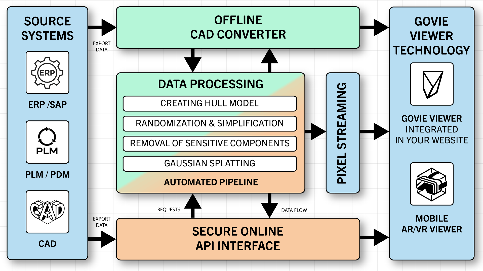
All geometry data displayed on modern graphics hardware is fundamentally readable. Primary protection measures are therefore applied before transmission: CAD construction data is destructively simplified in the pipeline so that, for example, only the outer shell is transmitted. Precise dimensions, construction history, and features are thus not reconstructible. For particularly sensitive 3D data, alternative representations are available that no longer contain usable construction data.
Technical Competencies
- IP Protection & Geometry Obfuscation: Feature removal removes feature trees, parameter values, and dimension chains. Geometric obfuscation (added micro-deviations) makes exported meshes unusable for reverse engineering.
- Alternative Representations: Gaussian Splatting or point cloud representation instead of polygon geometry. These representation forms prevent reconstruction of precise CAD geometries while still offering complete visual quality.
- Pixel streaming: With this type of solution, 3D content is rendered server-side and transmitted to the client only as a compressed video stream. Geometry and raw data remain on the server.
Platform-independent compatibility for BIM, GIS, and LIDAR data as well as proprietary CAD data
Compatibility
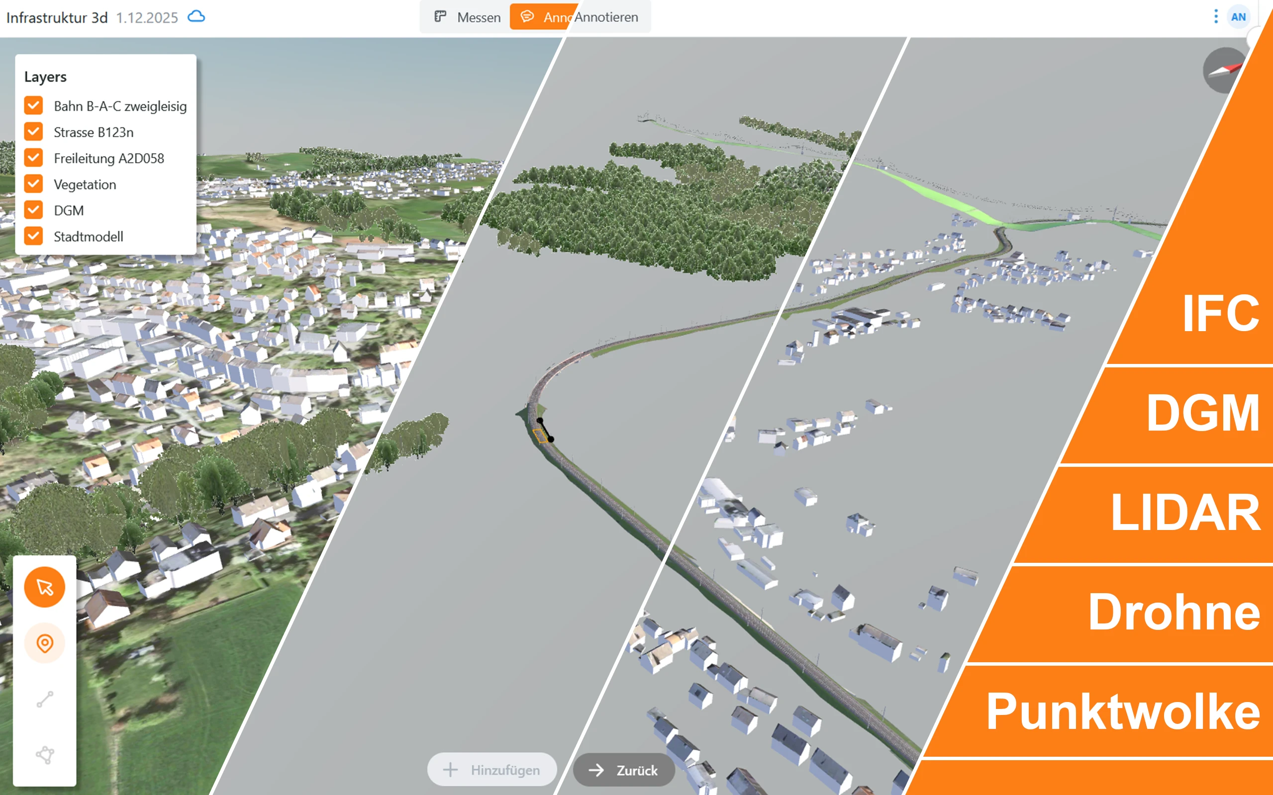
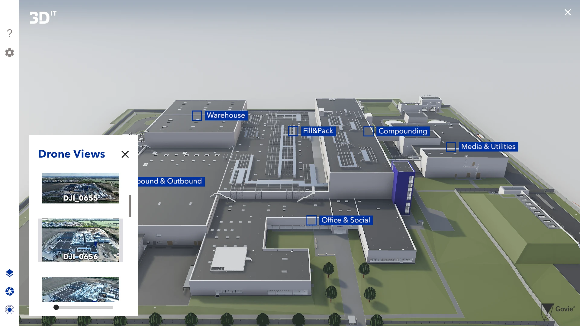
The Govie 3D engine processes heterogeneous data sources through two complementary strategies: A conversion pipeline transforms proprietary and standardized formats (CAD, BIM, GIS, LIDAR) into unified internal representations (meshes, point clouds, 3D Tiles).
A spatial coordinate transformation unites georeferenced data from various source systems into a global coordinate system. The viewer displays all data sources geometrically and spatially correct, regardless of format and origin.
A spatial coordinate transformation unites georeferenced data from various source systems into a global coordinate system. The viewer displays all data sources geometrically and spatially correct, regardless of format and origin.
Technical Competencies
- Data Conversion Pipeline: Proprietary and standardized formats (STEP, IFC, DWG, RVT, LAS) are automatically converted into a unified viewer format. Normalization of orientation, dimension, and geometry types enables uniform display of all sources.
- Geodetic Coordinate System: All input data is transformed into a shared ECEF (Earth-Centered, Earth-Fixed) coordinate system, allowing georeferenced data from different origins to be displayed with geometrically correct overlay.
Landingpages
Landingpages with Live-Demos
Everything you need to know about interactive 3D product presentations
Frequently asked questions
What do you need from us to create an interactive 3D product presentation?
Ideally, you provide us with CAD data of your product. Our review to check whether the data is suitable is free of charge. We would be pleased to conclude a non-disclosure agreement. If you don't have CAD data, e.g. because it's about an entire application environment, give us pictures or sketches and we will model it. If you would like to show components or processes in action, you can help us with videos of how they work or with simulations. You can also provide us with texts and other media to enrich your interactive 3D product presentation.
How will our know-how be protected in an interactive 3D product presentation?
A 3D product presentation contains no more CAD data. All meta information has also been removed. Reverse engineering is no longer possible! And anything you don't want to show in your interactive 3D product presentation can simply be deleted from your 3D product model.
We have hundreds of product variants. Won't 3D product presentations be too expensive?
We then develop a so-called pipeline for model preparation. The pipeline largely automates what highly qualified 3D artists and designers would otherwise do by hand. Personnel costs and model preparation time are drastically reduced. This makes interactive 3D product presentations affordable even if you have thousands of products.
What if we only have a very small budget?
While our interactive 3D product presentations offer superior benefits, they are often no more expensive than "3D" videos. Alternatively, you should look at our Govie Editor: This allows you to produce interactive 3D presentations (Govies) of your products yourself and publish them on all conceivable end devices - all this without any programming knowledge. Many users who can invest the necessary time achieve very good results, especially with projects of moderate complexity.
We are familiar with 3D. Can we reduce costs by doing some work ourselves?
Yes, you can. First of all, you can reduce your CAD models yourself. We would be happy to show you how we need them. If you are able to design and animate the 3D models yourself, e.g. with Blender or 3dsmax, they are already suitable for creating interactive 3D product presentations. In addition, our Govie Editor can be used to create impressive interactive 3D product presentations without any programming knowledge.
Our agency also does 3D. What's the difference?
There are many agencies that turn 3D models into stylish images and videos. But videos are not 3D, they remain a 2D medium. You can tell a real interactive 3D presentation by the fact that your product is in a 3D world. You can turn it around and even look into it - while all the animations go on. This is not possible in video or in the real world and it has been proven to result in greater involvement and superior product understanding. We do not replace your existing agency, we complement it and enjoy working together.
And what about VR, AR, MR, XR and the Metaverse?
We supply 3D content for virtual reality (VR), augmented reality (AR), mixed reality (MR) and metaverse as forms of extended reality (XR). We know how you can integrate it into VR, AR and MR applications and use it there. In short: it all starts with 3D(IT). Talk to us!